


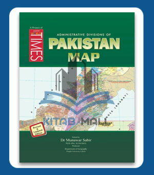
JWT The Political World Map
🗺️🌍 JWT Political World Map – A colorful, up-to-date map showing all countries, capitals & borders! 🏙️📌 Perfect for CSS, PMS & classroom use! 🎯📚
₨ 250
In stock
🗺️ JWT The Political World Map – Learn the World at a Glance!
🗺️🌍 JWT The Political World Map is a must-have educational tool for students, teachers, and competitive exam aspirants. Featuring clearly marked countries, capitals, and political boundaries, this laminated wall map enhances geographical knowledge and global awareness. 🎯📌
Perfect for CSS, PMS, and general knowledge prep, it’s also an excellent addition to classrooms and study spaces. Durable, up-to-date, and easy to read — a smart investment in your learning journey! 📚✨

Description
🗺️🌍 JWT The Political World Map is an essential visual aid for students, educators, and competitive exam aspirants. This high-quality, laminated map clearly displays the world’s political boundaries, country names, capitals, and major cities — making it perfect for study, reference, or display. 📚🖼️
📌 Key Highlights:
✔️ Up-to-date Political Boundaries – Includes all recognized countries and capitals as per the latest international data 🏙️📍
✔️ High-Resolution Print – Sharp text and vibrant colors for easy readability and effective learning 🎨👓
✔️ Durable & Laminated – Tear-resistant and waterproof for long-lasting use 💪💧
✔️ Ideal for Competitive Exams – Especially helpful for CSS, PMS, FPSC, and other general knowledge prep 🎯📝
✔️ Perfect for Classrooms & Study Rooms – Hang it on the wall for quick reference and daily revision 🧠🖼️
🔎 Whether you’re a geography lover, a serious aspirant, or a teacher, JWT The Political World Map is your go-to resource for global awareness and smart learning. 🌐✨
Specifications
- 🗺️ Title: JWT The Political World Map | Format: Laminated Wall Map | Size: Approx. 24 x 36 inches
- 📌 Features: Updated country boundaries, capitals, major cities | Ideal For: CSS, PMS, school & home study use
Reviews
Only logged in customers who have purchased this product may leave a review.
Related products
-3%
-7%
-8%

-6%
-5%
-5%
There are no reviews yet.